

Descripción
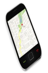
The increase in bicycle traffic has implications not only on the environment but our health as well. The GPS system has offered engineers the ability to gather terrain information more efficiently than traditional techniques. Not only can terrain information be gathered but also route calculations, which allow civic planners the ability to track trends in traffic. Design a safe bycicle route using a GPS
It is an educational content by education.com.
By clicking on the title of this resource, you will be redirected to the content. If you want to download the project, you just have to join the website, which now is for FREE.
Autores
Autor Melissa Bautista
Categorias 14-16 años, Ficha para imprimir, Experimento/Práctica, 12-14 años, 10-12 años, Science Fair - Education, Tecnología, Inglés add
Tag add
Data de publicação 27 / 08 / 2020
Licença Respeita a licença original do recurso.
Deseja fazer um comentário? Iniciar sessão
GPS Navigation
Comentários
mode_comment0